 Los Adaes State Historic Site
15 km
Very pretty place to come with your family to learn some history and have a picnic
Los Adaes State Historic Site
15 km
Very pretty place to come with your family to learn some history and have a picnic Los Adaes State Historic Site
15 km
Superb Archaeological Interpretive Site! One can see the outline of the Presidio, see...
Los Adaes State Historic Site
15 km
Superb Archaeological Interpretive Site! One can see the outline of the Presidio, see... Battle of Pleasant Hill
29 km
This site is an optimum statement on the war and the cause of the Southern people. Th...
Battle of Pleasant Hill
29 km
This site is an optimum statement on the war and the cause of the Southern people. Th... Battle of Pleasant Hill
29 km
This is one of my favorite battle sites west of the Mississippi River. Unique to this...
Battle of Pleasant Hill
29 km
This is one of my favorite battle sites west of the Mississippi River. Unique to this... Fort St. Jean Baptiste State Historic Site
34 km
I really enjoyed the friendly staff who not only knew a lot about the history of the ...
Fort St. Jean Baptiste State Historic Site
34 km
I really enjoyed the friendly staff who not only knew a lot about the history of the ... Beau Fort Plantation
38 km
Beau Fort is a magnificent property with a fascinating history. The owners have done...
Beau Fort Plantation
38 km
Beau Fort is a magnificent property with a fascinating history. The owners have done... Cane River Creole National Historical Park
38 km
Scenic area. Worth a stop if you are in the area. Easily to walk with flat foot paths...
Cane River Creole National Historical Park
38 km
Scenic area. Worth a stop if you are in the area. Easily to walk with flat foot paths... Melrose Plantation
41 km
Excellent tour of older, historic plantation home. Visited twice. Once during a tour ...
Melrose Plantation
41 km
Excellent tour of older, historic plantation home. Visited twice. Once during a tour ... Mansfield State Historic Site
51 km
I didn't know anything about this place until my team and I toured it. The staff is e...
Mansfield State Historic Site
51 km
I didn't know anything about this place until my team and I toured it. The staff is e...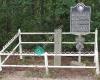 Historical Marker Republic of Texas and Loui...
77 km
This is the only remaining international boundary marker within the United States, pl...
Historical Marker Republic of Texas and Loui...
77 km
This is the only remaining international boundary marker within the United States, pl... Mickleville Louisiana
86 km
Historic Mickleville named for a beautiful Lady who's nickname is Mickle.
Mickleville Louisiana
86 km
Historic Mickleville named for a beautiful Lady who's nickname is Mickle.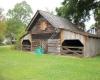 Kent Plantation House State Historic Site
94 km
I loooovvvve this place. The staff is friendly and knowledgeable about the history. I... Southern Hills Healthcare and Rehabilitation
95 km
If I could give no star I would. My mother was left in a pile of feces for an hour. S...
Kent Plantation House State Historic Site
94 km
I loooovvvve this place. The staff is friendly and knowledgeable about the history. I... Southern Hills Healthcare and Rehabilitation
95 km
If I could give no star I would. My mother was left in a pile of feces for an hour. S... Forts Randolph & Buhlow State Historic Site
96 km
The interpretive center is worth the trip alone. Elevated wooden walkways surround th...
Forts Randolph & Buhlow State Historic Site
96 km
The interpretive center is worth the trip alone. Elevated wooden walkways surround th...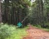 Historic Camp Claiborne Main Entrance
103 km
The Wild Azalea trail is adjacent and they are in bloom spectacular! Louisiana Maneuvers Landmark
105 km
Historic Camp Claiborne Main Entrance
103 km
The Wild Azalea trail is adjacent and they are in bloom spectacular! Louisiana Maneuvers Landmark
105 km
to add Fort Jesup State Historic Site map to your website;